
Quick info
- A long traverse with some technical sections high above the Soller valley
- Needs rappel gear to stay on the ridge proper
- Can be combined with an ascent of Penyal de Migdia
General
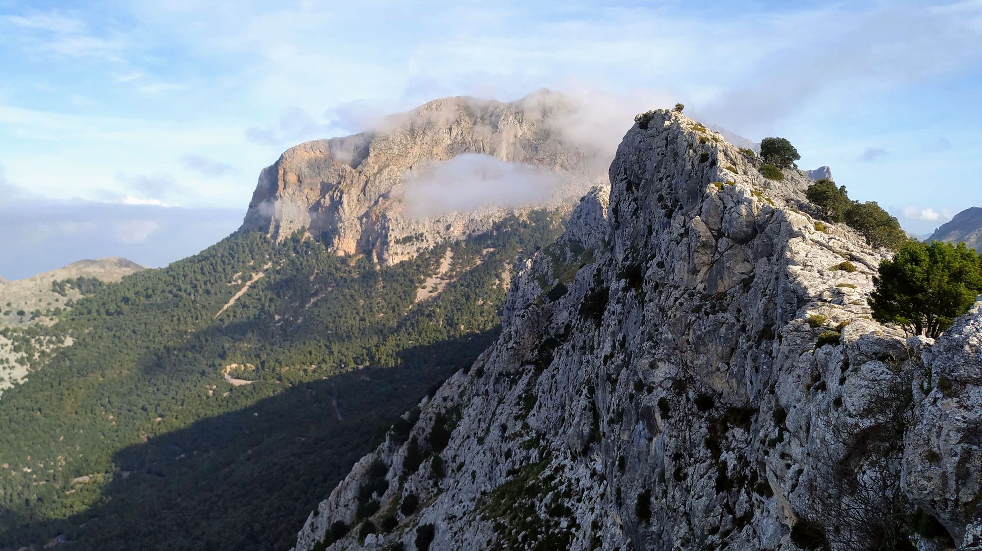
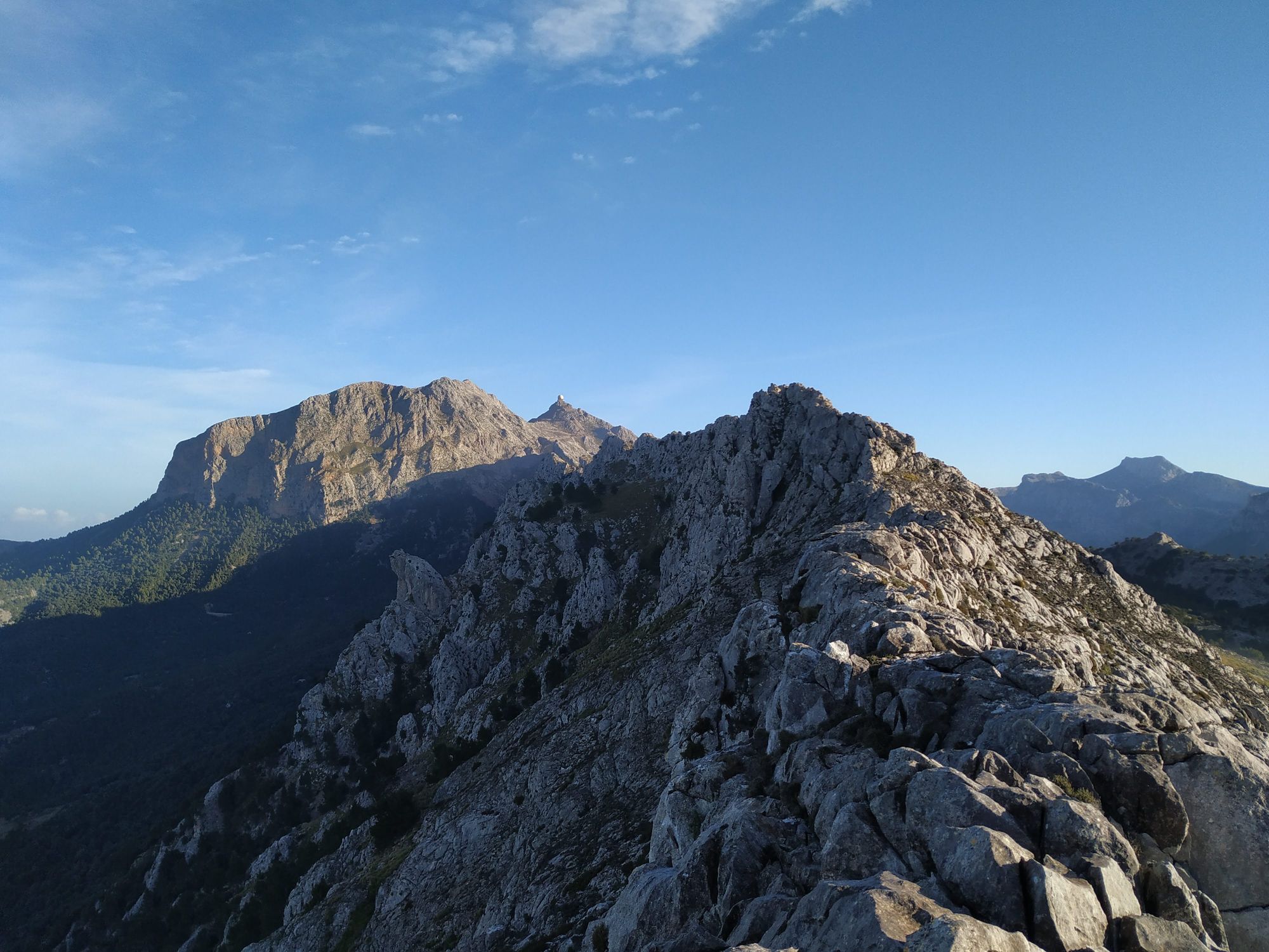
Looking up from the town of Soller and beyond the orange and olive groves the Serra de Torrella presents itself as a line across the sky. It runs for four kilometers from south-west and connects to the massive Penyal de Migdia and Puig Major at its end in the north-east.
It can be traversed in both directions, however ending at the Penyal de Migdia side allows to add this peak at the end and to stay high in the ridge all the way including two rappels (which would either have to be circumnavigated coming from the others side or be climbed as trad climbs).
The Serra traverse is not only fun but also provides some of the best views of the high northern Tramuntana and the picturesque Soller valley - all with the backdrop of the deep blue mediterranean sea.
Logistics
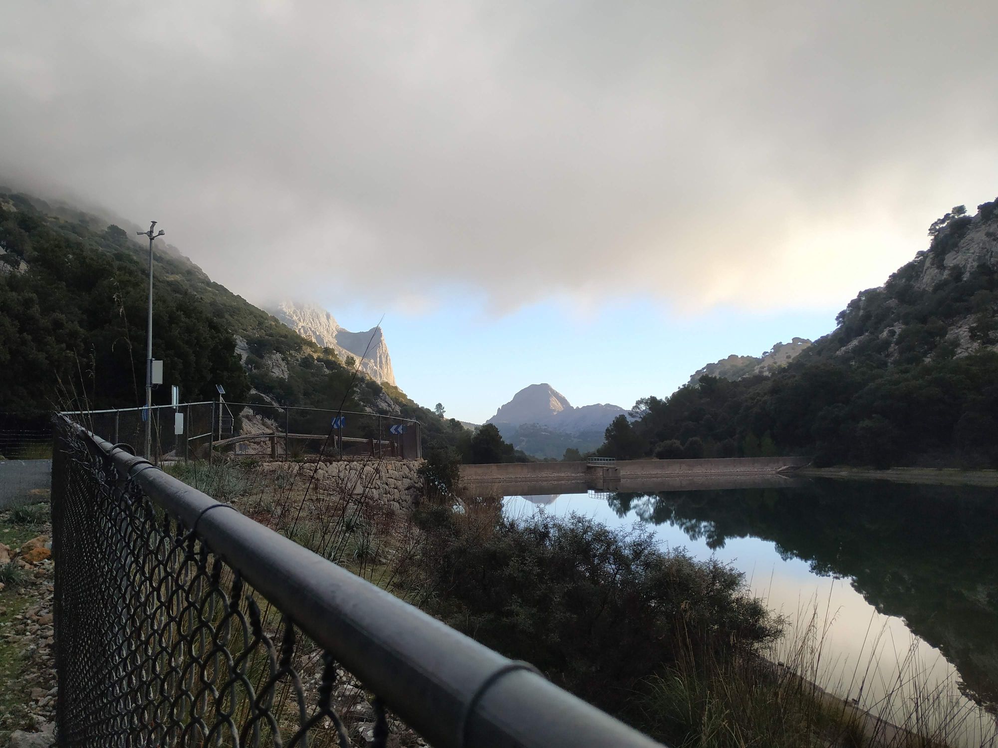
Coming up the from Soller on the Ma-10 find a parking spot a few hunderd meters before the Tunnel de Monnáber. During the main holiday session and especially on weekends it might be difficult to get a spot.
Approach
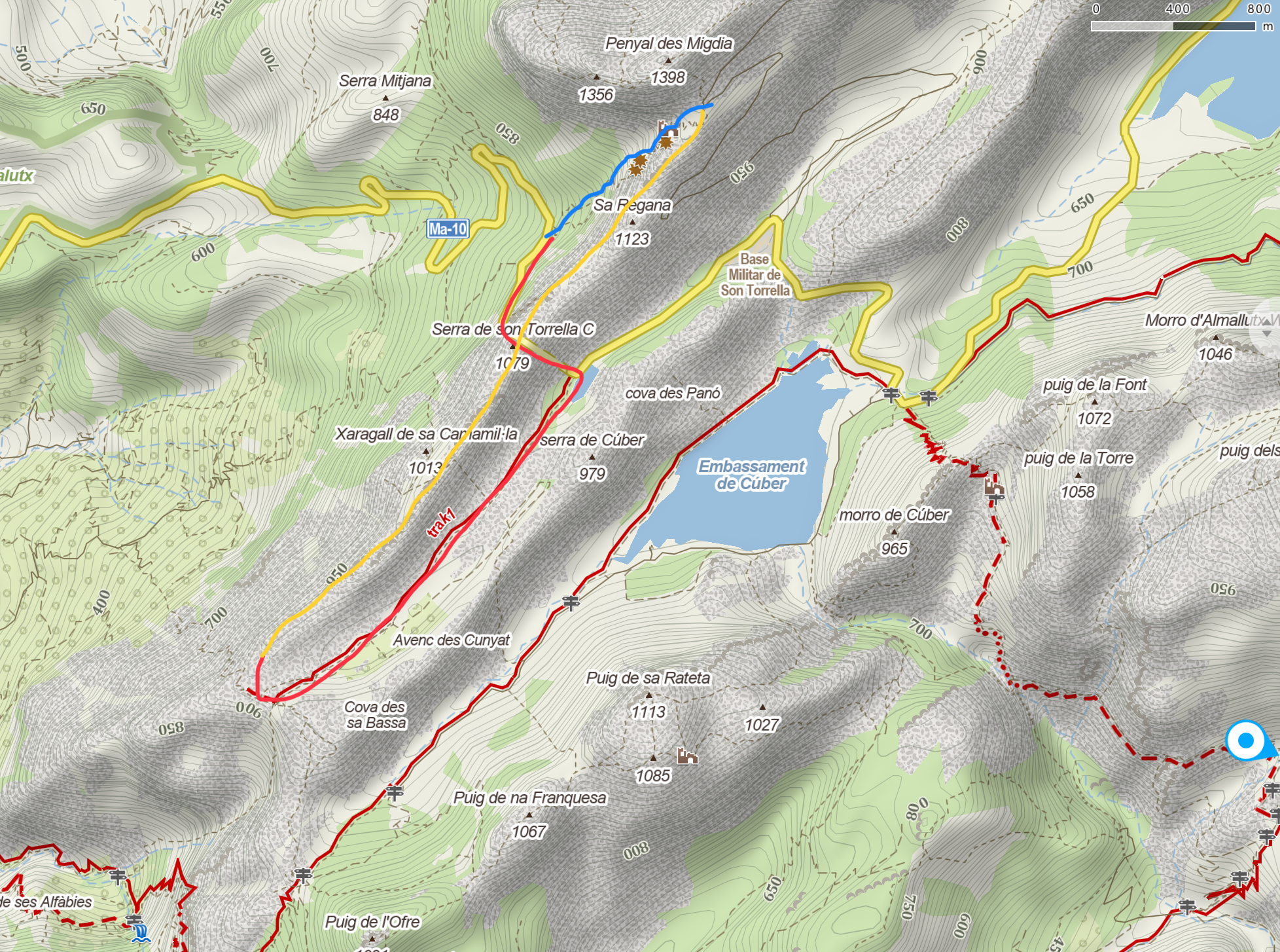
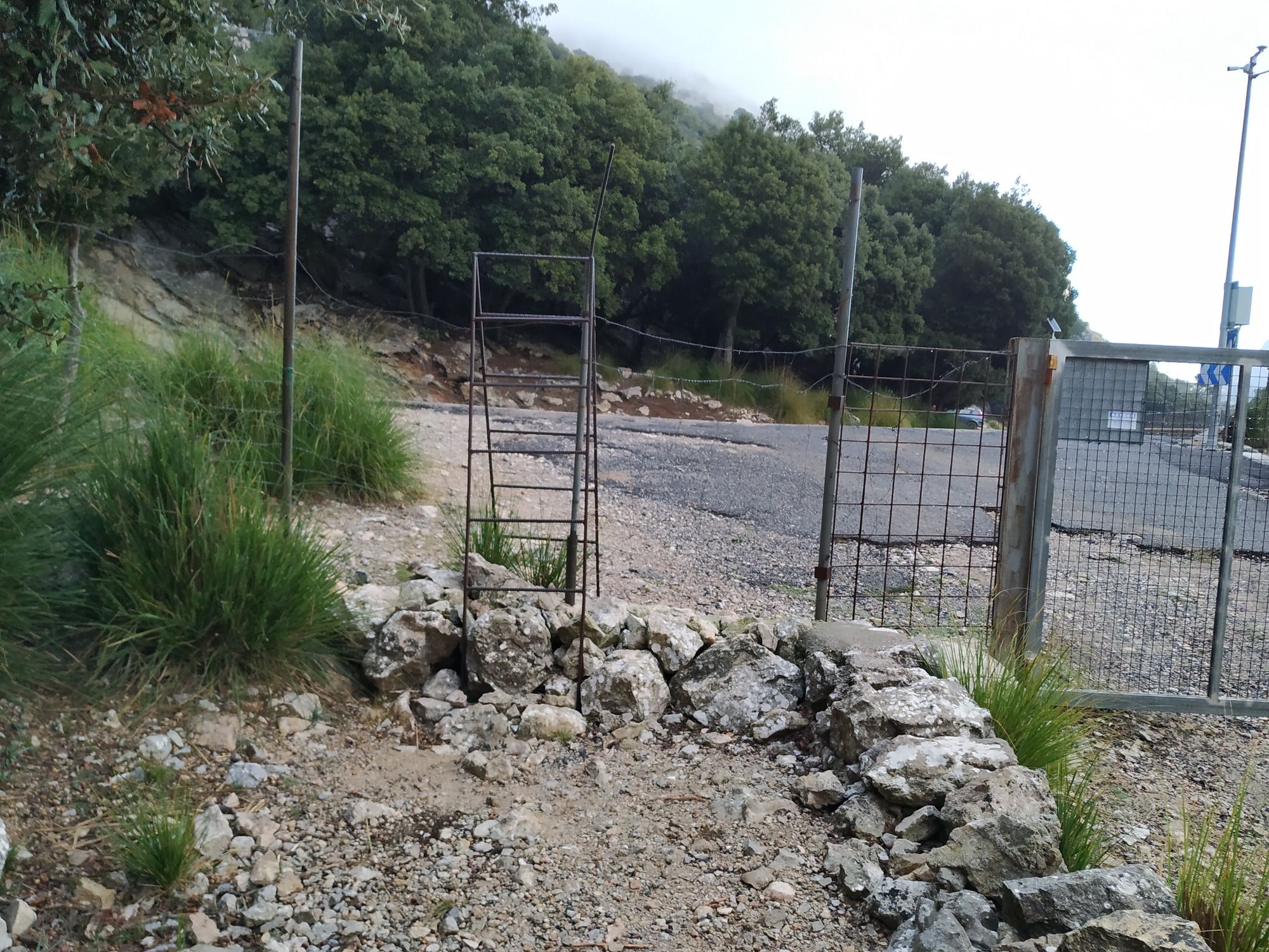
From the parking lot follow the Ma-10 upwards, walk through the tunnel (take care!) and right after exiting the Tunnel turn right unto a hiking path (cross a fence with a small ladder). Walk on this path slightly uphill for about 2 kilometers with the Serra de Torrella on the right hand. You will reach the Coll de ses Solanes and a small dry stone wall afterwards (make sure to go up to the wall and take in the views!). To start the actual ridge turn almost 180 degrees and make your way up until you reach the steep drop towards Soller.
After fininishing the ridge either directly take the steep hiking path down the canal towards the car (passing a few former ice storage houses) or find the path leading up to the peak of Penyal de Migdia in the bend of the road leading up to the military base on Puig Major. If you walk up to the Penyal descend back to this point and then follow the canal down.
Technical information
- Fairly long route with a hiking approach and descent plus four kilometers of ridge walking / scrambling. Depending on how quickly your party moves in alpine terrain the ridge itself can take anywhere from 3.5 to 6 hours and the approach and descent another 45-60 min each.
- For the two rappels: 40 meter rope and rappel device. Possibly the rope can come in handy at the more exposed bits.
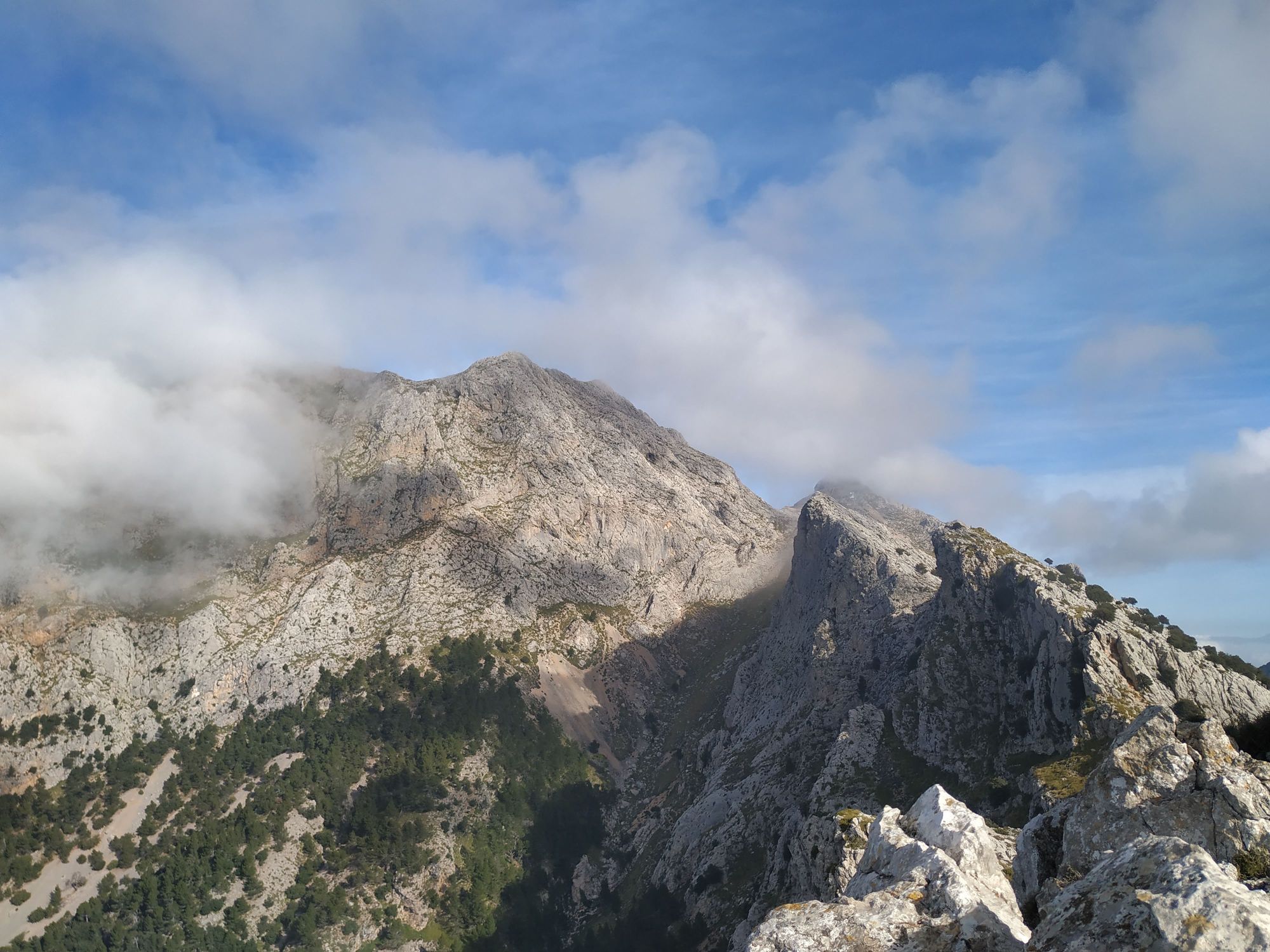
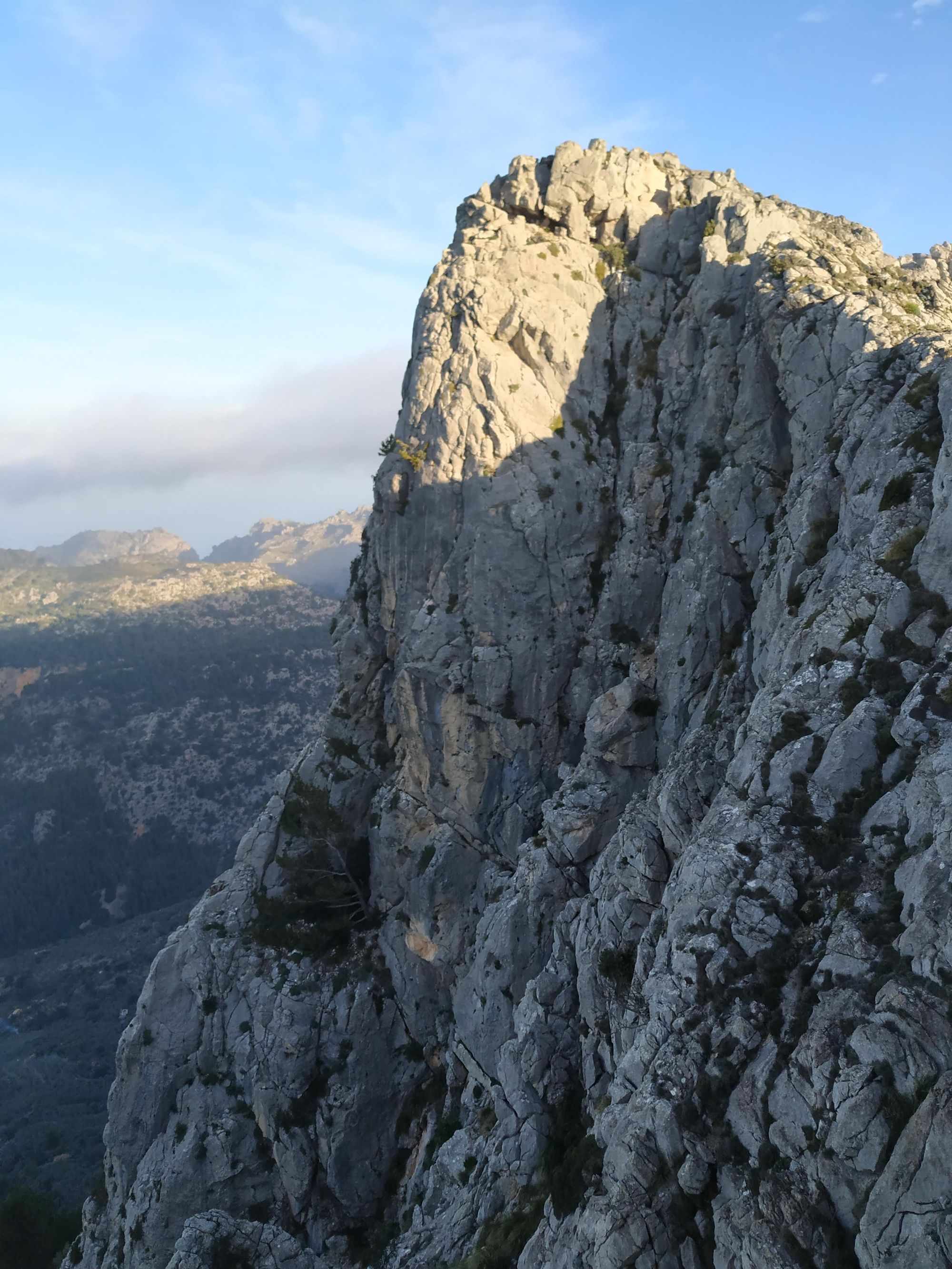
- The ridge is very steep on the northern side but there are many possible exits towards the south and the approach trail.
- Take special care not to slip when moving on the north side of the ridge: The rock here stays wet a long time and is covered in lichen.
- The rock quality on the ridge is variable. Keep and eye out for recent rock falls and possibly change your route slightly to avoid dangerous sections.
Route finding
The route we will describe is from south-west to north-east.
- From the Coll de ses Solanes easily scramble up unto the ridge.
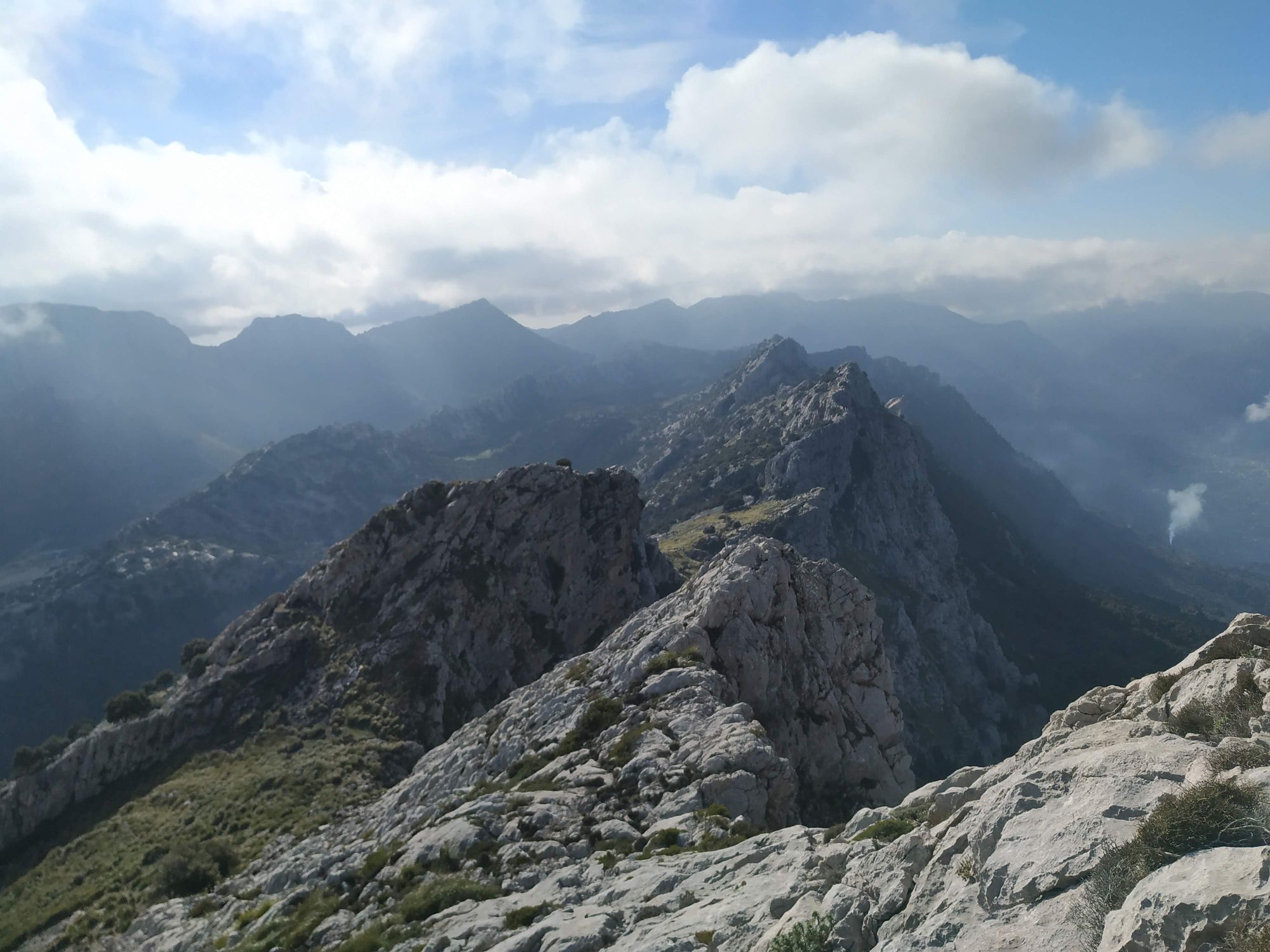
- Follow the ridge as high as possible. The terrain never gets really difficult.
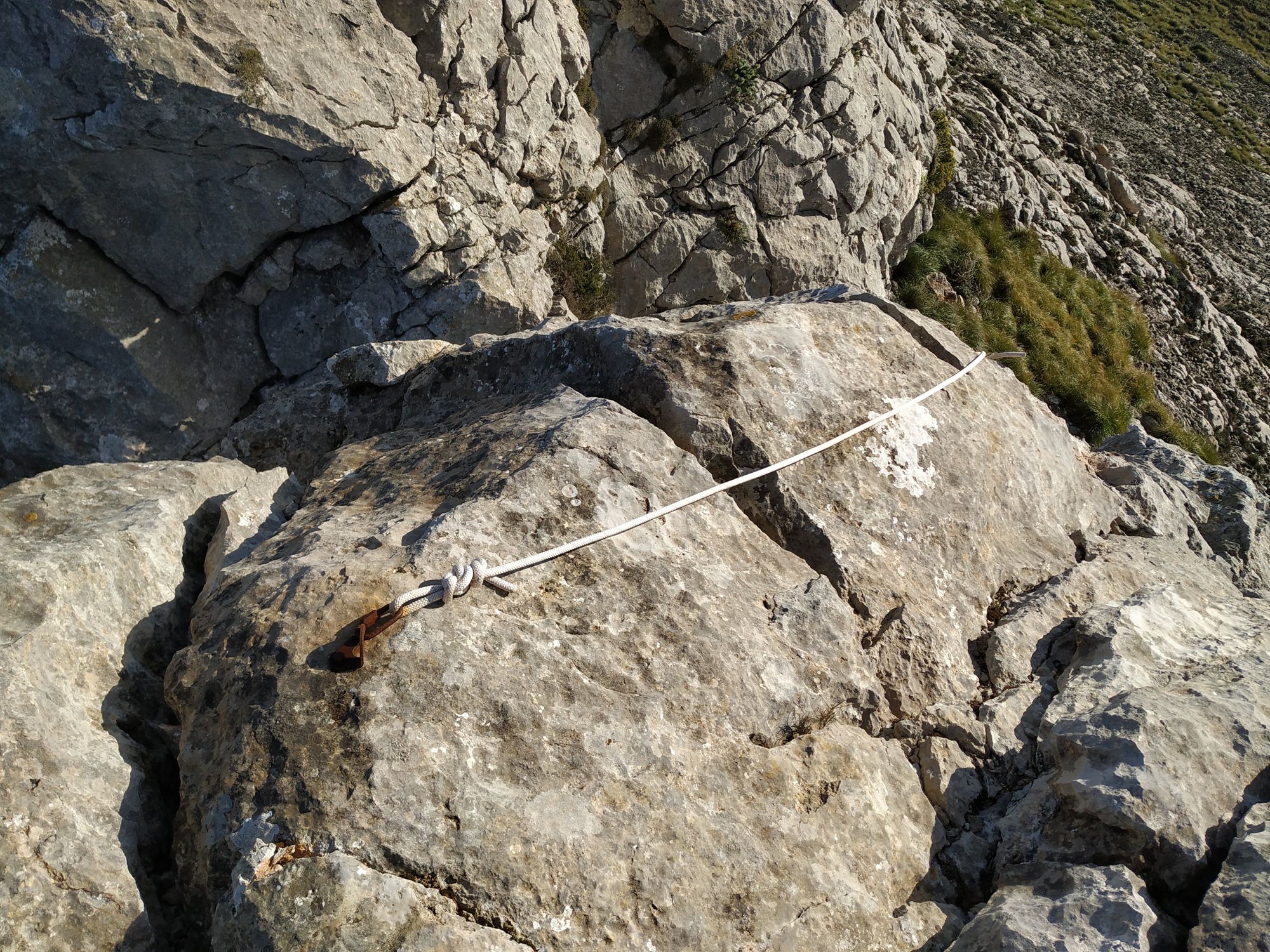
- After a good while there is a steep gap in the ridge. Look out for a rappel station here. The fist bolt you will see is very rusty and connected to a better set with a rappel ring a bit further down. Rappel off (freely hanging) into the gap.
- Cross over a short very exposed section after the rappel and continue on the ridge for some time.
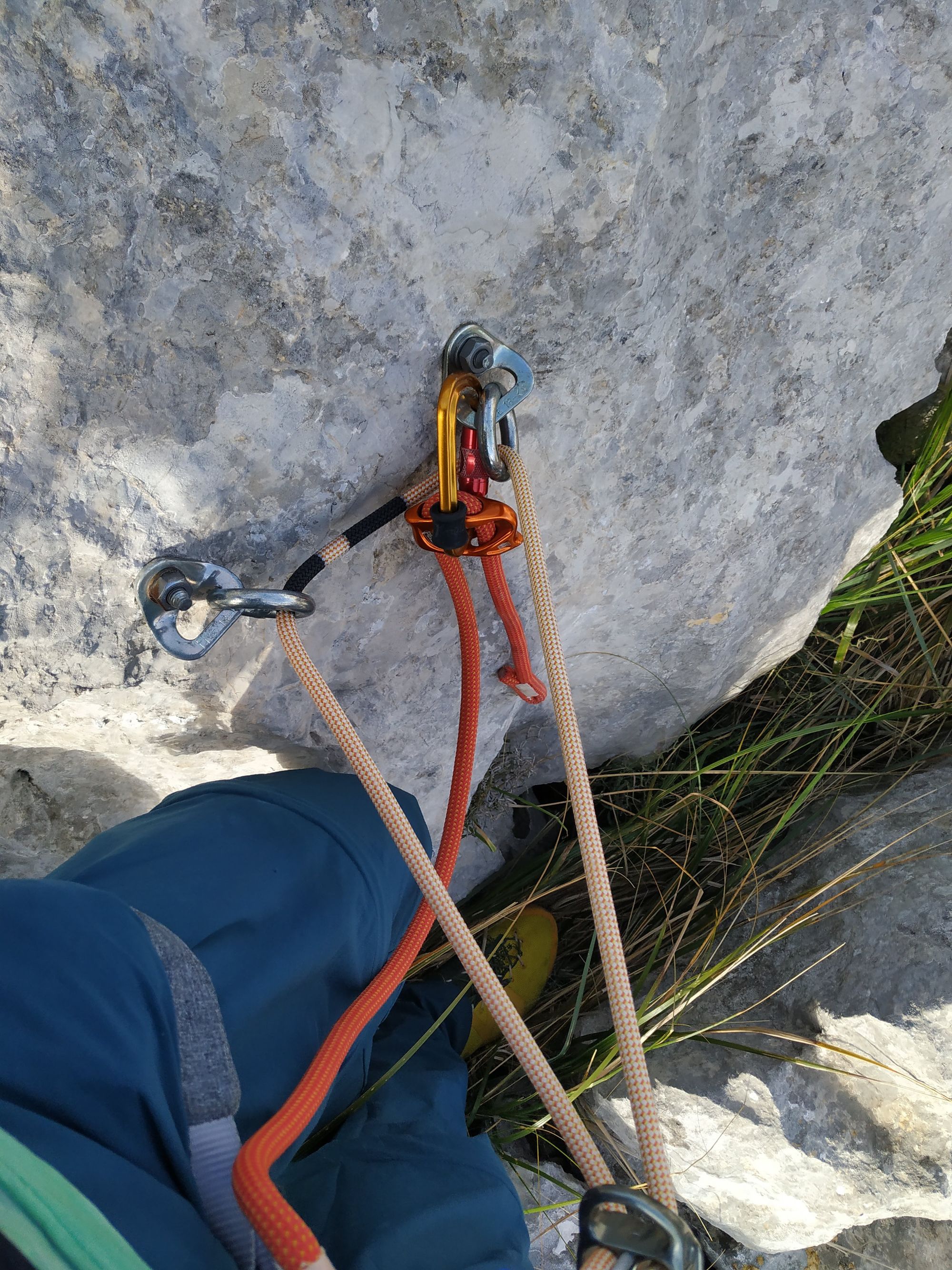
- At another drop find the second rappel station. This time two expansion bolts with a rappel ring. Rappel and make your way up the ridge again via a short section of easy climbing up a small canal (very loose rock!). There is an old belay at the top which you could use to protect a follower.
- The ridge stays easy until the very last bit which is fairly exposed.
- You will finish on a small grassy field right at of a bend of the road leading up the military base on Puig Major.