A midweek adventure in the rain and wind
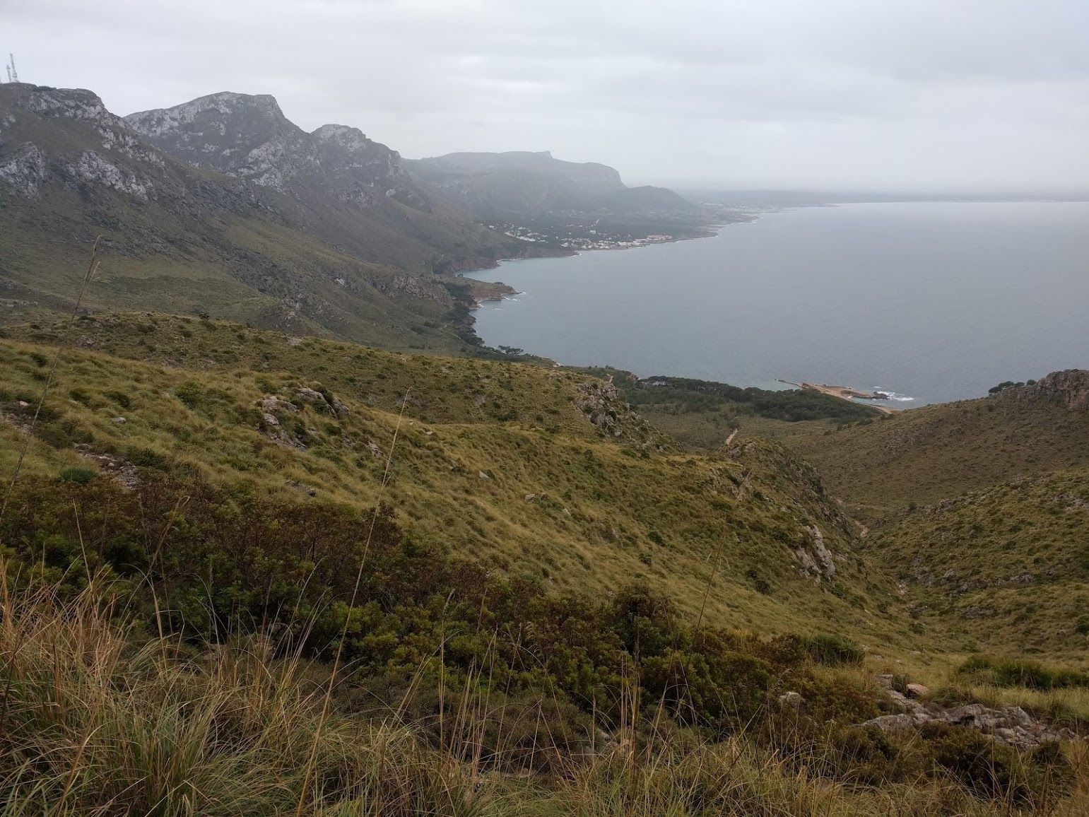
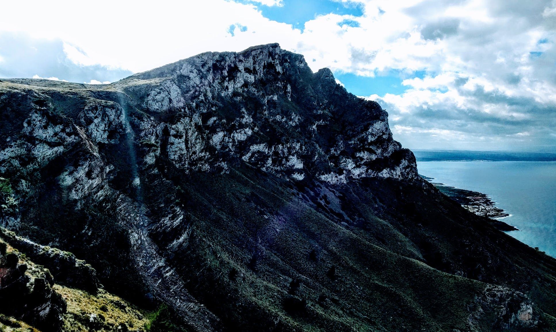
While the real mountains on Mallorca are all clustered on the west coast, there a a few peaks on the north-east coast that rise right out of the sea up to 550m and are quite rugged with imposing rock faces. For this short excursion I simply looked at a topo map and decided that there would be a possible line up one of the hills. In the end I did make it up with a few adjustments. In this article I give a bit of a play-by-play of this climb. Fair warning this might get detailed and nerdy. Another warning: I am not a super skilled mountaineer or rock climber but I would like to share my experiences in learning this stuff.
I my quest to improve my skills in scrambling and pathfinding on mountains I took a look at opentopomap.org (highly recommended!) and selected a route up on of the peaks in the Parc Llevant on Mallorca. With a 450m rise right from the coast and knowing that there is a rock face right below the summit plateau I thought this would be a good “training” hill. Looking at the map I figured that first following the “torrent” (sort of a couloir draining water from the hill), then switching over to a spur leading to the rock face and finally trying to find a way up the face. Besides the last bit the incline did not look to bad, however there would be a lot of vegetation and possibly some steeper rocks on the spur before reaching the more challenging part of the ascent. You can see that plan marked on blue on the map.
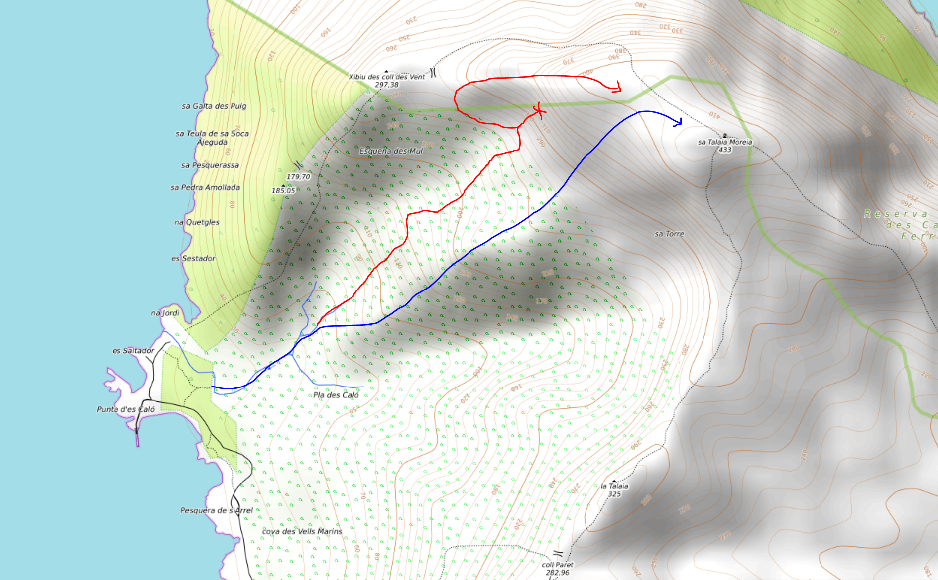
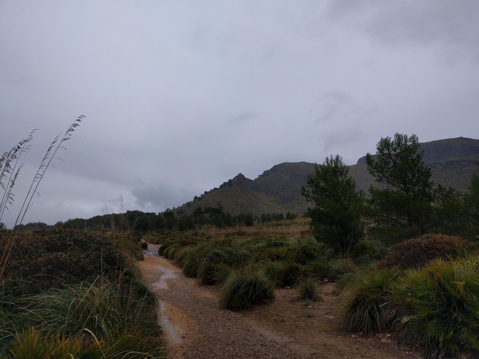
The day I did this trip the weather was actually quite miserable: Constant rain and strong wind forecast for the whole day. I set of from a village on the coast and hiked to the point at which the torrent drains into the sea. From there I went off path as planned into the torrent (which carried no water at this point). Going up the I noticed there was a second spur a bit further left up the the rock face which was not noted on the map. It had much less vegetation on it and the exposed rock looked nice and grippy (which was welcome in the rain). I decided to switch over to that spur as I could always cross the couloir further up to get back on the original route. My detour is marked in red on the map and the two views of the hill.
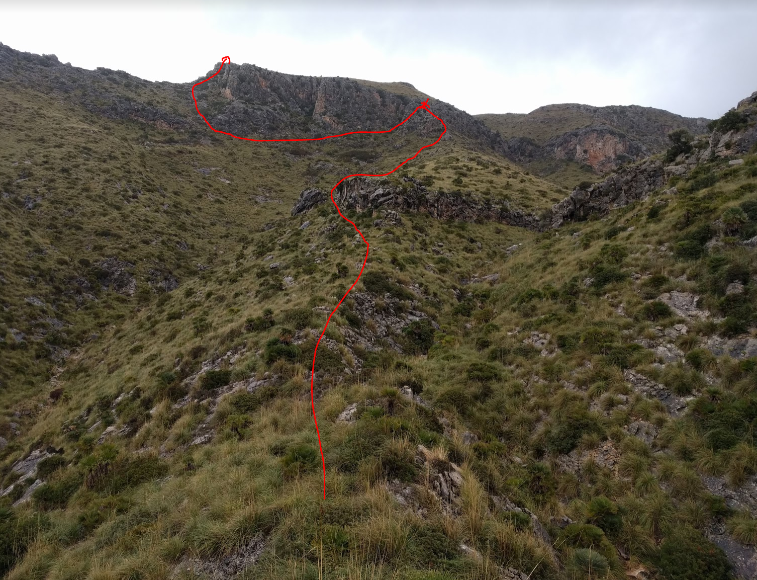
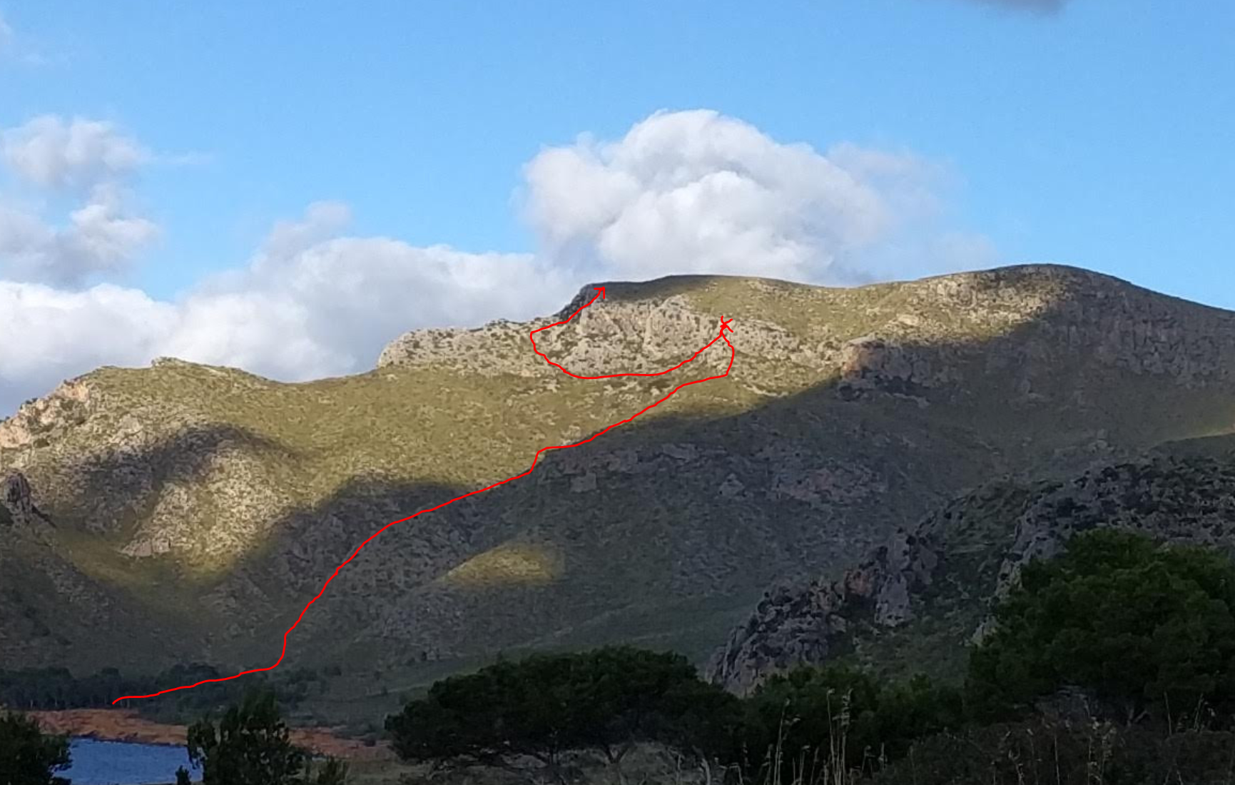
I followed up the spur and and had to scramble around a two large rock features to get to the final rock face. During the way up I saw that what looked to be a break in the rock face again further left on the hill. I took mental note of that but continued up to the face. There is a clear line through the actual face but after trying for maybe 20 min I decided that in the wet this would be to dangerous solo. Remembering the gap in the face I then traversed a few hundred meters to the left and after a bit of scrambling I was through the gap and on what at that point I thought would be the peak.
However I quickly noticed that I only climbed up on a ridge that ended in another now only 10m high rock face. After some looking around I found a maybe one meter wide crack in the rock that led up. Climbing through the crack was a bit tricky with the rocks being slippery from the rain but there was no big danger as any fall would be stopped by the walls of the crack. After scaling this last obstacle I was on the plateau and started to walk towards the actual summit a few meters higher. Visibility quickly got worse as low clouds came in and I had to do some more wayfinding but in the end I found the highest point.
Getting down was less eventful as I took a trail (even though getting of the rock face involved some downclimbing and cursing). All in all this excursion was great fun and served its purpose as training in reading the terrain, taking decisions accordingly and keeping stuff under control - even if you need to adapt your original plan.
Adventurers: Bengt